 From a FEMA press release:
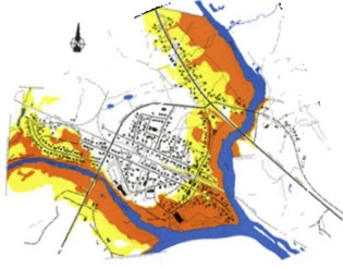
Collier County and the cities of Naples, Marco Island and Everglades City have received updated, preliminary Digital Flood Insurance Rate Maps (DFIRMs) from the Federal Emergency Management Agency (FEMA).
Staff from the respective communities are now reviewing the maps for accuracy.
A series of public informational meetings is scheduled for this week that will allow property owners to view the new maps, understand how their properties may be affected and learn more about the financial steps that they may need to take to comply with federal flood insurance requirements.
Flood Insurance and Community Outreach Specialists from FEMA and other staff from the county and the municipalities will be available to answer questions and provide information.
The public meetings are scheduled for the following locations:
Monday, August 16, 2010
5:00 p.m. – 8:00 p.m.
St. John’s Church
625 111th Ave. North NaplesTuesday, August 17, 2010
4:00 p.m. – 7:00 p.m.
Norris Community Center
755 8th Ave. South NaplesWednesday, August 18, 2010
5:00 p.m. – 8:00 p.m.
IFAS/UF Extension Service Bldg.
14700 Immokalee Road NaplesThursday, August 19, 2010
12:00 p.m. – 3:00 p.m.
City Hall
Council Chambers
207 Broadway
Everglades CityThursday, August 19, 2010
5:00 p.m. – 8:00 p.m.
Mackle Park
1361 Andalusia Terrace
Marco IslandFriday, August 20, 2010
5:00 p.m. – 8:00 p.m.
Immokalee Community Park
321 North 1st Street
ImmokaleeThe meetings will use an open room format for property owners to walk from table to table to obtain flood zone information, ask questions about flood insurance, learn about the public review and comment period, talk to county, city and FEMA staff, pick up useful brochures and learn about the proposed schedule for making the DFIRMs effective for building permits and flood insurance.
There are no planned opening presentations, so residents can feel free to arrive at any time that best suits their schedules.
It is expected that shortly after the public meetings, FEMA will publish two notices in the newspaper to start the official 90-day time period for owners to file any comments, protests, or appeals. Following this, there will be a period of time to resolve comments, protests or appeals before FEMA finalizes the DFIRMs to make them effective.
Flood risk maps are used by FEMA to set flood insurance rates, regulate floodplain development, and inform those who live and own property in a high risk floodplain (with a 1% annual chance of flooding in any given year) of potential hazards, and they require continuous maintenance and revision due to land development and natural changes to the landscape.
Collier County is not alone in this endeavor. FEMA’s Map Modernization Program of 2003 to 2008 resulted in new or revised digital flood maps for 92 percent of the continental U.S. population.
The new DFIRMs are very different in appearance from the current FEMA flood mapping in that they will identify the risk from coastal storm surge flooding as well as rainfall from the coastline to roughly State Route 29. Many areas of the county that had been exempt under previous flood zone mapping will now be included. Those who have a federally backed mortgage or plan to refinance with a federally backed lender, may be required to purchase flood insurance if they find that their home is newly shown in a Special Flood Hazard Area on the updated maps.
More questions? Check ou Collier County’s flood map website or FEMA’s wesite on FIRMs.